Call for Abstracts: Academic Track
Academic Track
This year’s State of the Map conference will again feature a full day Academic Track session. Following on from the great success of the inaugural Academic Track session at SotM 2018, this session will showcase both the ongoing innovation and maturity of scientific investigations and research into OpenStreetMap. Building upon the motto of SotM 2019 in “Bridging the Map” the Academic Track session will provide the bridge to join together the experience, understanding, ideas, concepts and skills from different groups of researchers, academics and scientists from around the world. In particular, the Academic Track session will provide a bridge to connect members of the OpenStreetMap community and the academic community by providing a open passage for exchange of ideas, communication and opportunities for increased collaboration. We expect empirical, methodological, conceptual, or literature-review-based contributions addressing any scientific aspect related to OpenStreetMap, in particular, but not limited, to the following:
- OpenStreetMap extrinsic and intrinsic quality assessment
- Analysis of contribution patterns in OpenStreetMap
- Integration and/or conflation of OSM data to generate new and scientifically valuable datasets
- Assessments of data import procedures and their impacts on data and community
- Data interplay between OpenStreetMap and other data sources (authoritative or user-generated)
- Analysis/comparison of available software for scientific purposes related to OSM
- New approaches to facilitate or improve data collection in OpenStreetMap (e.g. through gamification or Citizen Science approaches)
- Bridging the communities: creating better connections and collaborations between the scientific community and the OpenStreetMap community
- Open research problems in OpenStreetMap and challenges for the scientific community
- Cultural, political, and organizational aspects of data production and usage practices in OpenStreetMap
Submission Guidelines
Authors are invited to submit abstracts using the State of the Map 2019 Pretalx submission system. Deadline for submission is May 10, 2019. Deadline extended to May 19, 2019.
Abstracts should include from a minimum of 500 to a maximum of 800 words.These limits will be strictly enforced for a fair and balanced review process.
Abstracts must be scientifically rigorous and the content should be structured as follows: introduction/background, where the problem addressed is introduced; main aim or purpose of the study; brief description of the methodology and findings achieved; final discussion highlighting the scientific contribution of the study and its practical benefits/implications. Abstract authors are free to organise their abstracts into appropriate sections or parts. The above structure is provided as a suggestion only.
There are no specific formatting or layout guidelines as the abstract will be submitted online in plain-text format.
Abstracts will be evaluated by the Scientific Committee. Authors of selected abstracts will be invited to give an oral presentation during the Academic Track sessions at the conference. The selected abstracts will be published as a collection with a distinct Digital Object Identifier (DOI) in an open access online repository (e.g. Zenodo).
The scientific committee will seek to further disseminate the contributions made to the Academic Track by organizing a Special Issue in a relevant, open access, scientific journal (e.g. ISPRS International Journal of Geo-Information or Open Geospatial Data, Software and Standards). Authors of the selected abstracts will be invited to submit a full paper to this Special Issue. Successful submissions will enjoy partial or full waiver of publication fees.
Timeline and Deadlines
30 March 2019: Deadline call for scholarship
25 April 2019: Deadline non-academic talk submissions
10 19 May 2019: Deadline academic talk submissions
20 June 2019: Program announcement
21-23 September 2019: State of the Map
Submit your presentation
Please submit your presentation proposal to our submission form.
Scientific Committee
You can reach the academic track committee via email to academic-sotm@openstreetmap.org.
-
 Dr. Marco Minghini
European Commission Joint Research Centre, Ispra, ItalyMarco studied at Politecnico di Milano, where he got a BSc and a MSc in Environmental Engineering with specialization in Geomatics and a PhD in GIS. After 4 years spent working as a Postdoctoral Research Fellow in the GIS group of GEOlab at Politecnico di Milano, he has recently joined the European Commission - Joint Research Center (JRC) in Ispra, Italy (Unit B6 “Digital Economy”), where he makes applied research on SDIs and the implementation of the INSPIRE Directive. Marco is an advocate of open source software and open data and has a long research experience in OSM. He is a Charter Member of OSGeo, Secretary of ISPRS WG IV/4 “Collaborative Crowdsourced Cloud Mapping (C3M)”, Member of the OpenStreetMap Foundation and Voting Member of HOT.
-
 Dr. A. Yair Grinberger
GIScience Research Group, Heidelberg University, GermanyYair earned his PhD in Geography from the Hebrew University of Jerusalem, studying human mobility behaviors using GPS traces. His current research focuses on modelling and quantitatively analyzing socio-cultural processes of data production and their traces in Volunteered Geographical Information datasets. His broader research interests include Geographic Information Science, critical GIS, and digital representations of socio-geographical phenomena.
-
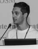
 Dr. Peter Mooney
Department of Computer Science, Maynooth University, IrelandPeter is a tenure track lecturer at the Department of Computer Science in Maynooth University in Ireland. Peter is recognised as one of the foremost experts in Europe on Crowdsourcing Geographic Information (CGI) and Volunteered Geographic Information (VGI). He has carried out extensive research on OpenStreetMap and other forms of VGI. He is author or co-author of over 40 peer-reviewed journal publications and over 100 conference publications. Peter uses OpenStreetMap extensively in his undergraduate and postgraduate teaching. In other duties he is co-chair of the Irish OSGeo Local chapter and European Co-Chair for GeoForAll. He has been involved in the academic and scientific committees for all major GIS conferences both in Europe and globally.
-
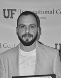
 Dr. Levente Juhász
GIS Center, Florida International University, USALevente, originally from Hungary, earned his PhD from the University of Florida. Currently he is with the GIS Center at the Florida International University in Miami, Florida. Previously, he was a visiting scientist at the Joint Research Centre in Ispra, Italy, at Carinthia University of Applied Sciences in Austria and he also served as a data scientist for a geospatial startup, Mapillary. His research interests revolve around understanding the nature of user-generated geodata.
-
 Dr. Godwin Yeboah
Institute for Global Sustainable Development, University of Warwick, UKGodwin is a Senior Research Fellow in Geographical Information Science with an interest in the assessment of, and contribution to, OpenStreetMap data and associated technologies for scientific research and sustainable development. He is a fellow of the Royal Geographical Society (with the Institute of British Geographers).
Language
The conference language of State of the Map is English. All presentations shall be held in English. It is an important aspect of the conference that visitors can interact with the speaker for questions and discussion.
Recordings
Video recordings and slides of the lectures will be published under the Creative Commons Attribution International 3.0 or later (CC BY 3.0+) license. If you do not wish your lectures to be published or streamed, please let us know in your submission.
Travel Costs and Visa
State of the Map is a non-commercial event where neither the organisers nor the speakers are being paid. Speakers have to buy a conference ticket just like everyone else. If necessary, we are able to provide limited support for travel costs. Our call for scholars is open until 30 March 2019.
If you need help applying for a visa, e.g. an official invitation to present to the German embassy, we can provide that. Please be aware that the visa application procedure may take several weeks or even months.
The SotM 2019 Scientific Committee, 15 March 2019
Proceedings
The full and individual talks’ proceedings of this track are published in digital form. Head over to the proceedings page for more information.